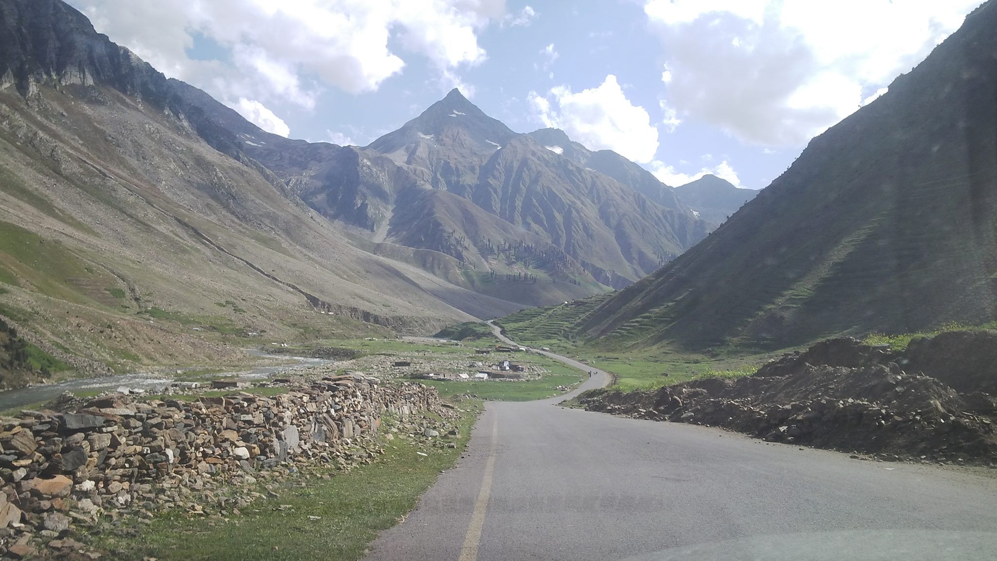
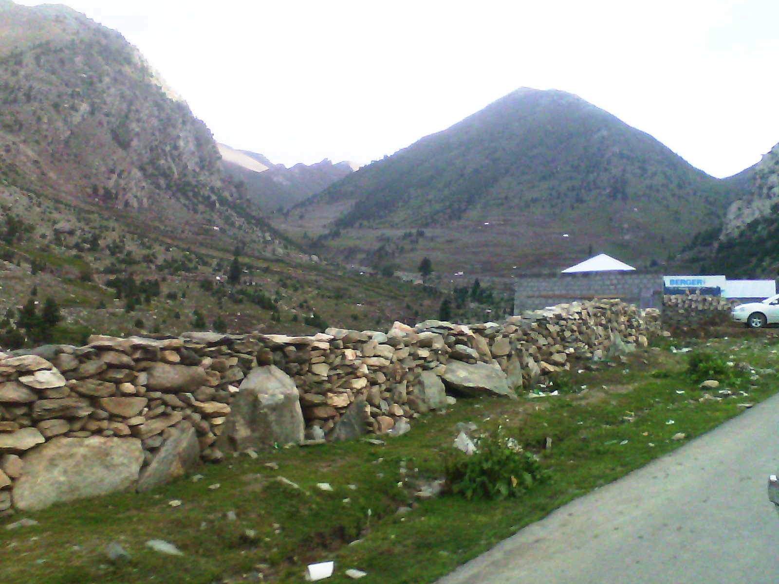
Babusar Pass connects Diamer district of Gilgit Baltistan with Kaghan Valley of Khyber Pakhtunkhwa province of Pakistan at an altitude of 4173 m. Babusar top road was first constructed by the British as an alternate route to connect the Gilgit agency with British India. In winter Babusar pass road is closed due to heavy snow falling at the top. The pass is only open from mid-June to September. Babusar road is one of the hair pinned roads in the world.

Historical Background
Babusar Top was a key route connecting Kaghan Valley to Gilgit-Baltistan, used from 1947 until the KKH opened in 1978. The British initially constructed this route in 1890.
Babusar Pass Facts
Altitude: 4,173 meters (13,691 feet)
Opening Time: June to early November
Scenery: Snow-capped peaks, glaciers, lush valleys
Activities: Photography, sightseeing, enjoying mountain landscapes
Nearby Attractions: Lulusar Lake, Dudipatsar Lake
Geography
Babusar Pass is located in Diamer District, Gilgit Baltistan. Geographically it is part of the Western Himalayan mountain range extending from Kashmir. The Kaghan Valley located in KPK side features the highest mountains in the area, including Malika Parbat (nearly 17,000 feet). During summer, nomadic communities graze livestock on the mountain grasslands.
Tourism
The journey from Islamabad to Babusar Top offers stunning views of lush green valleys of Hazara, streams, forests, and meadows. Lulusar Lake is a notable tourist spot on the way to the top. Babusar Top is a must-visit, attracting many tourists from the country in summer. It’s a perfect spot for short trip and exploration.
Precautions
If you are travelling first time to Gilgit Baltistan by road then carefully read these precautions:
- Check Babusar Top Road Conditions before travelling.
- During monsoons, the area receives heavy rain. Roads may close due to land sliding.
- Before leaving for a trip check the weather forecast.
- Make sure your car’s brakes, exhaust systems, and heater are in good condition.
- Use lower gear while crossing the pass.
- Security officials may stop you to cross pass after 05:00 PM so make sure to reach Babusar before this time.
Plan Your Trip to Gilgit Baltistan
First, plan your trip. Prepare well before travelling. Take some warm clothes, jackets, sunglasses, and hiking items. Decide whether you want to stay at a hotel or want to stay in a camp. If you want to stay at camps then bring camping equipment like tents, sleeping bags, etc with you. Now if you are ready then see the route map. Also bring eatable items from nearby towns.
Also, Read Karakoram Highway Road Trip Cross Country Adventure in Gilgit Baltistan.
Naran Babusar Top Chilas Road N15 Route
The road to Naran and Babusar is officially called N15 in Pakistan. The Naran Jalkhand Chilas road starts from Mansehra Hazara Khyber Pakhtunkwa Pakistan.
Places to see on Naran Babusar Road
The whole route is beautiful lush green and stunning. Here is a list of some famous places.
Balakot
Balakot is located 38 km from Mansehra. The city is the gateway to Naran valley and Babusar pass. Balakot is a famous tourist destination. The river Kunhar runs via Balakot. The city was destroyed during the 2005 earthquake.
Naran
Naran is a town located 119 Km from Mansehra. There are many hotels to stay in Naran ranging from high-luxury hotels to average ones. Naran receives heavy rain in monsoon and winter. In winter tourists from Pakistan visit Naran to see snow. For places to visit refer to this post best places to visit in Naran Kaghan Pakistan.
Lulusar Lake
Lulusar Lake is one of the most beautiful and the largest lake in Naran valley.
Babusar Top
The view from the Babusar top is stunning. You can see Malika e Parbat, Nanga Parbat, the snow-capped peaks of Gilgit Baltistan and lush green meadows. The distance between Gilgit city and Babusar is 180 Km.
Thak Babusar Valley
While travelling on Babusar road towards Gilgit Baltistan you will descend via Thak valley till zero point. At zero-point Karakoram Highway meets with Babusar road (N15). Now you can further travel towards Gilgit Baltistan on Karakoram Highway. It takes 2 hours to reach Jaglote from zero point. Jaglote is the junction point of three roads: Skardu road, Astore road, and KKH. If you follow KKH you will reach Gilgit and Hunza Valley. If you want to visit Skardu then follow Skardu road.
FAQs
Where is Babusar Pass located?
Babusar Pass is a high-altitude mountain pass which connects Kaghan Valley, KPK to Diamer, Gilgit-Baltistan and known for its stunning natural beauty.
What is the Distance from Islamabad to Babusar Top?
The distance is approximately 349.5 km, about a 6-hour and 53-minute drive via Hazara Motorway/M-15 and N-15.
When is the best time to visit?
The best time to visit is from May to September when the weather is mild, and the pass is accessible.
Is Babusar Pass open year-round?
No, it’s typically open from mid-June through September, closed during monsoon and winter seasons.
What are some nearby attractions to Babusar Pass?
Nearby attractions include Lalazar meadows, Dudipatsar Lake, and Lulusar Lake.
Are there any facilities or amenities available ?
Yes, there are some shops on the top but facilities are limited. You have to stop at Naran or Chilas to get best facilities.
Read Top Places to visit in Skardu Wonders of the World

Also, Read Deosai National Park All things you need to know
Skardu.pk is one of the leading authentic news and information platform focusing on adventure tourism, regional and world affairs.
